What a Tracker Does on Safari
A tracker reads spoor — prints, dung, feeding signs, disturbed grass — while the guide drives and interprets. The role has formal qualifications: CyberTracker evaluations graded from 70% to 100%, feeding into FGASA’s Tracker I, II and III certificates., the dry winter. Rainfall is near zero, wildlife concentrates at Etosha’s waterholes, and roads are at their best. July and August are the peak — and the coldest, near 6 °C at dawn.
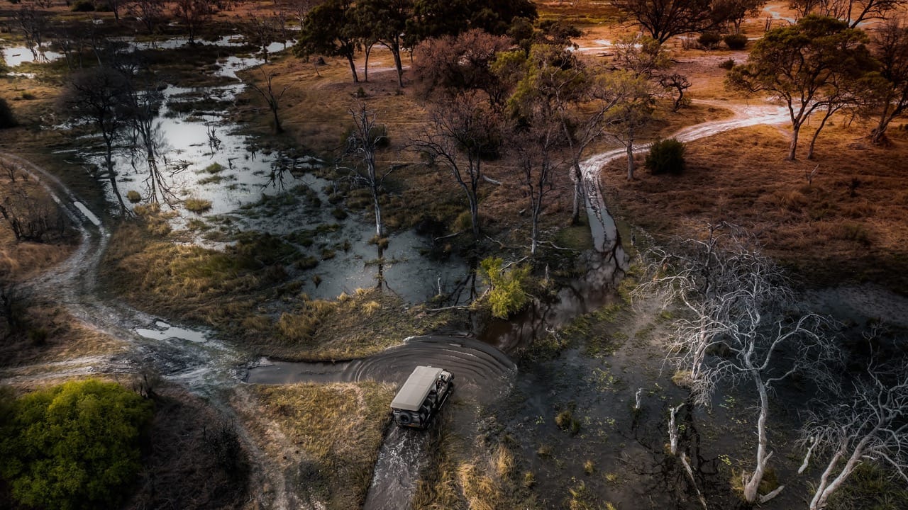
On most safari vehicles the person doing the hardest work is sitting outside it. The tracker rides on a seat mounted at the front, watching a strip of ground a few metres wide, and from that reads which animals crossed the road, how long ago, and whether following them is worth the next two hours. It looks like intuition. It is a documented skill with a grading system and a peer-reviewed literature.
The job, and why the seat is where it is
The division of labour is practical. The guide handles the vehicle, the radio and the guests. The tracker handles the ground. Sitting at the front rather than inside gives an uninterrupted sightline to the road surface ahead — the faintest impression of a pad on rock, a bent blade of grass, a dung pile still holding moisture. From a passenger seat, all of that is gone before you have seen it.
The unglamorous truth is that tracking often fails. Following a trail can take hours with no animal at the end of it. What the tracker is really doing is a continuous cost-benefit calculation — is this spoor fresh enough, clear enough and heading somewhere accessible enough to be worth the morning.
It is a graded qualification, not a knack
CyberTracker certification is the backbone. Track and Sign evaluations are scored against a set of specimens in the field, and the levels are explicit: 70% for Level I, 80% for Level II, 90% for Level III, 100% for Level IV, with a Specialist tier requiring a perfect score across more than fifty deliberately difficult specimens. A separate Trailing evaluation tests following an animal rather than identifying its sign, and the combined Tracker grade is the lower of the two — you cannot compensate for weak trailing with good identification.
Those certificates then feed a wider ladder. FGASA’s guiding qualifications run from Nature Site Guide at NQF2 through NQF4 with 260 logged field days, to Professional Field Guide at 520 days. The dangerous-game walking qualifications sit above that and require tracking explicitly: Professional Trails Guide demands a Tracker II certificate, 600 hours of walking and 300 dangerous-game encounters, and the top SKS Dangerous Game qualification requires Tracker III, 1,200 hours as first or second rifle and 600 encounters.
Namibia’s own professional hunting and guiding qualifications run through courses accredited by the Ministry of Environment, Forestry and Tourism, with NAPHA among the training providers, followed by written and practical ministry examinations and an apprenticeship. The detail available publicly on that pathway is much thinner than for FGASA and CyberTracker, so treat specifics with more caution than the numbers above.
Tracking as published science
This is the part that surprises people. In 1997 the Journal of Zoology published “Tracking and the interpretation of spoor: a scientifically sound method in ecology” by Stander and colleagues — co-authored with two Kalahari San trackers, ≠Oma Kxao and /Ui. Indigenous trackers as named authors of a peer-reviewed paper, not as subjects of one.
The work continued. Liebenberg and colleagues published in Biological Conservation in 2017 on smartphone interfaces designed so that non-literate trackers could record citizen-science data directly. Keeping and colleagues published in the same journal in 2018, comparing tracker-based wildlife counts against conventional aerial surveys in Botswana. Several San co-authors reached CyberTracker Master Tracker status.
The origin of all this is worth knowing. In 1990 a San tracker named !Nate approached Louis Liebenberg after fencing across the Kalahari disrupted game migration and made traditional hunting unsustainable. The question was how to create paid work for people whose skill no longer had an economy attached to it. The first CyberTracker certification followed in 1994.
Where the tradition is still working
The Nyae Nyae Conservancy in Otjozondjupa, established in 1998 as one of Namibia’s first communal conservancies, covers roughly 899,200 hectares across 40 villages with a Ju|’hoansi population of around 3,400. The Nyae Nyae Pangolin Project, set up there in 2021 by the Pangolin Conservation and Research Foundation, employs San trackers to find, tag and monitor pangolins.
The results are not decorative. Eleven full-time rangers and forty short-term trackers have identified 35 pangolins and fitted GPS and VHF tags to eight, producing 1,333 spatial data points over 22 months — including a male whose 96.9 square kilometre home range is the largest recorded for any pangolin species anywhere. Four pups were documented between August and December 2023. The project aims for one ranger per village by 2028.
Much of what is written about safari tracking online is lodge marketing, and it tends to romanticise. The material above is deliberately drawn from certification bodies and peer-reviewed literature instead. Where the public record is thin — Namibia’s own guiding pathway, in particular — this post says so rather than filling the gap.
If tracking interests you, the animal it is most often deployed on is also the hardest to find: our guide to Namibian leopards explains why the territories here make that so difficult. For what trackers are actually reading in a desert environment, how Namibian wildlife survives covers the behaviour behind the sign. A seventeen-day route gives enough guided time for the difference between a driver and a tracker to become obvious.

Frequently asked questions
What is the difference between a guide and a tracker?
The guide drives the vehicle, interprets what you are seeing and looks after the guests. The tracker reads the ground — footprints, dung, feeding signs, broken grass — and works out what passed, when, and in which direction.
Why does the tracker sit on the front of the vehicle?
For the sightline. From a seat mounted at the front, the tracker can read the ground ahead of the vehicle before the tyres reach it. From inside the vehicle that view is gone.
Is there a formal qualification for trackers?
Yes. CyberTracker runs Track and Sign and Trailing evaluations at graded levels, and FGASA’s guiding ladder builds Tracker I, II and III certificates into its higher guide and trails qualifications.
How do the CyberTracker levels work?
Track and Sign is scored: Level I is 70%, Level II is 80%, Level III is 90% and Level IV is 100%, with a Specialist tier requiring 100% on a test of more than 50 very complex specimens. A separate Trailing evaluation runs alongside, and the combined Tracker certificate takes the lower of the two scores.
Who created the CyberTracker system?
Louis Liebenberg, with the first certification held in 1994. It began in 1990 when a San tracker named !Nate asked for help after Kalahari fencing disrupted migration routes and made traditional hunting unsustainable — the aim was to create paid work for trackers.
Has tracking been validated scientifically?
Yes. Stander and colleagues published “Tracking and the interpretation of spoor: a scientifically sound method in ecology” in the Journal of Zoology in 1997, co-authored with the Kalahari San trackers ≠Oma Kxao and /Ui. Later work compared tracker-based counts against conventional aerial surveys.
Desert Tracks works with guides across Namibia and the wider region. Tell us what you want to understand out there and we will match the trip to the right people. Tell us what you want out of the trip rather than when you can travel, and we will tell you honestly whether your dates fit — including when the answer is that they do not. Get in touch with Desert Tracks.