Namibian Beach Holidays: What the Coast Is Really Like
A Namibian beach holiday is not a swimming holiday. Sea temperatures at Swakopmund run roughly 13.4°C to 19°C, the coast is fogged in for much of the year, and the appeal is dunes, wildlife and space rather than warm water., the dry winter. Rainfall is near zero, wildlife concentrates at Etosha’s waterholes, and roads are at their best. July and August are the peak — and the coldest, near 6 °C at dawn.
The Namibian coast is one of the strangest shorelines on earth: the oldest desert in the world running straight into a cold Atlantic, fog rolling inland over the dunes most mornings, and 1,500 kilometres of it almost entirely empty. What it is not is the Indian Ocean. Anyone arriving expecting to swim will be surprised within about four seconds of getting in.
The water is genuinely cold
Published sea-temperature datasets disagree slightly, but not about the substance. Swakopmund runs from roughly 13.4–13.7°C at its coldest in August and September to about 18.5–19.1°C at the February peak; Walvis Bay is much the same. For comparison, Durban on the Indian Ocean side is around 21°C in its coldest month — warmer, all year, than Namibia’s warmest.
That matters for more than comfort. The RNLI classes water below 15°C as cold water, where the involuntary gasp reflex and cardiovascular strain make drowning a real risk even for strong swimmers. On this coast the sea is below that threshold for roughly six months of the year.
What the coast is actually for
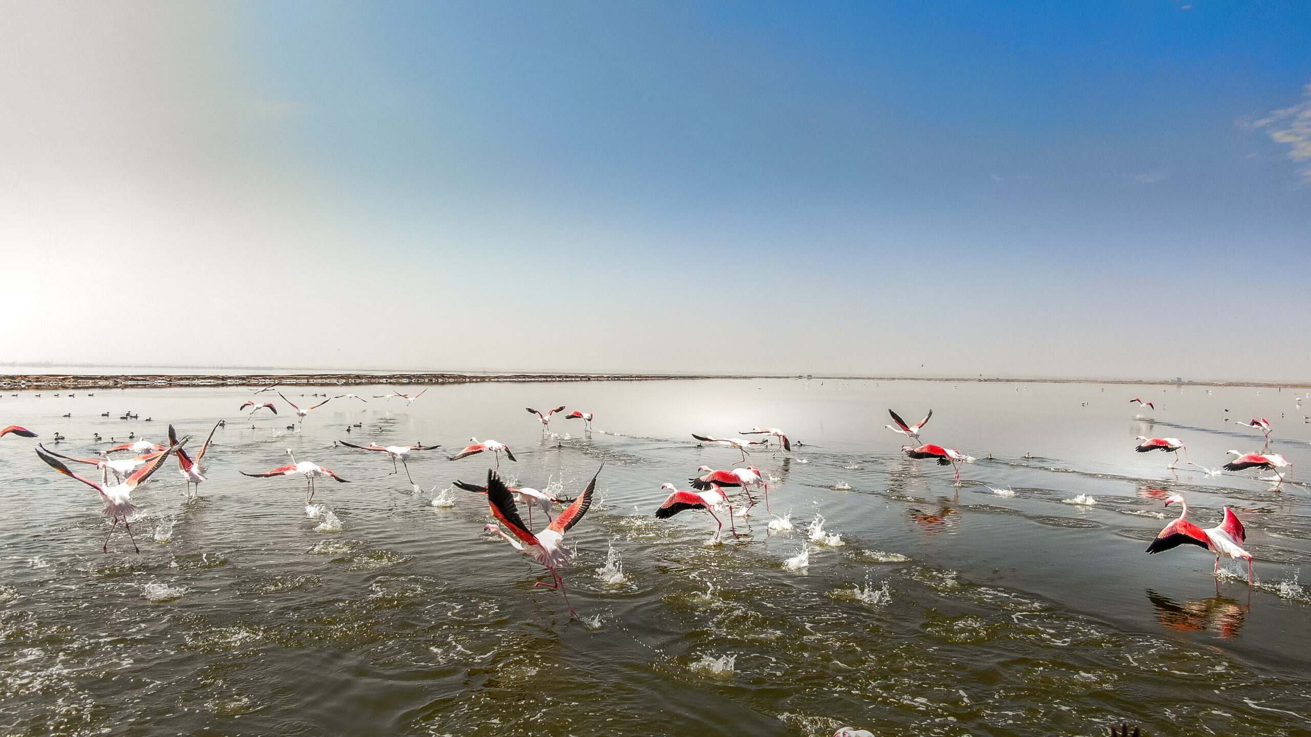
Walvis Bay lagoon was designated a Ramsar wetland of international importance on 23 August 1995, covers 12,600 hectares, and regularly supports between 37,000 and 79,000 waterbirds along with eleven endangered species. Boat trips run out across it to Pelican Point, where the reliable sightings are Cape fur seals, pelicans and the small resident dolphins rather than anything larger.
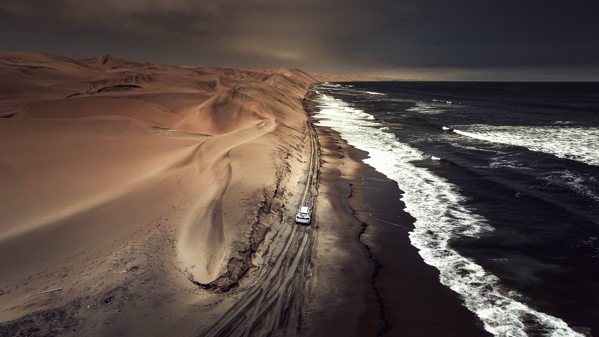
Sandwich Harbour, about 80km south, is a second Ramsar site, number 743, designated the same day. It sits inside Namib-Naukluft Park and needs a permit from the Ministry of Environment, Forestry and Tourism office in Swakopmund. The drive is only passable for a few hours around low tide and the beach hides patches of waterlogged sand, which is why almost everyone goes with a guided 4×4 rather than alone.
North of Henties Bay, Cape Cross Seal Reserve was proclaimed in 1968, covers 60 square kilometres and holds up to 210,000 Cape fur seals during the November and December breeding season. It opens daily from 10:00 to 17:00 and is a day visit only. Diego Cão landed here in 1486 and put up a stone cross; a replica still stands.
Fog, wind and the honest version
The coast gets less than 20mm of rain a year and is instead fed by fog. Published figures differ — one source says more than 180 days of thick fog a year, another around 200 — but either way, mornings are frequently grey and visibility can drop below 30 metres. The prevailing wind is a steady south-westerly. Afternoons often clear.
Safety is worth being plain about. Namibia has exactly one shark attack recognised by the International Shark Attack File — a non-fatal bite at Walvis Bay in October 2014. The hazards that deserve respect here are cold water and rip currents, and no source could be found confirming that any Namibian beach is lifeguarded.
None of this is a reason not to go. It is a reason to plan the right trip. If you want to lie on sand in the sun, this is the wrong coast and there is no version of the itinerary that fixes that. If you want dunes falling into the Atlantic, a lagoon full of flamingos, shipwrecks and the emptiest coastline you will ever stand on, it is close to unmatched.
December and January are when Namibians themselves holiday on the coast. It is the warmest window and the busiest one, and coastal accommodation books up well ahead.
Most people fold the coast into a longer loop rather than making it the whole trip: Hosea Kutako to Windhoek is 45km, and Windhoek to Swakopmund another 352km on the B2. A fifteen-day family route typically gives the coast three or four nights alongside Sossusvlei and Etosha. If there is surf in the forecast, the left-hander at Skeleton Bay is a short drive from Walvis Bay, and the history of Walvis Bay itself explains why the port looks the way it does.
Frequently asked questions
Can you swim in the sea in Namibia?
Rarely comfortably. Sea temperatures at Swakopmund and Walvis Bay run from about 13.4°C in late winter to roughly 18.5–19°C at the February peak. The RNLI classes water below 15°C as cold-water-shock territory, which the Namibian coast is for around half the year.
Why is the water so cold on a desert coast?
The Benguela Current pushes cold water north along the coast and upwelling brings more cold water to the surface. The same mechanism produces the fog the coast is known for.
What do people actually do on the Namibian coast?
Dune and desert trips, Sandwich Harbour 4×4 excursions, boat cruises out of Walvis Bay, angling, and Cape Cross. The coast is a landscape and wildlife destination rather than a sunbathing one.
Do I need a permit for Sandwich Harbour?
Yes. Sandwich Harbour sits inside Namib-Naukluft Park and requires a permit from the Ministry of Environment, Forestry and Tourism office in Swakopmund. The route is only passable for a few hours either side of low tide, which is why guided 4×4 trips are the norm.
When is the Namibian coast busiest?
December and January, when Namibian families take their own holidays on the coast. Book earlier for that window.
Are there sharks?
Namibia has a single shark attack recognised by the International Shark Attack File, at Walvis Bay in October 2014. It was not fatal. Cold water and rip currents are the real hazards.
Desert Tracks builds coastal and desert journeys through Namibia, including the permits and guides the restricted areas need. Tell us how long you have and we will shape the route. Tell us what you want out of the trip rather than when you can travel, and we will tell you honestly whether your dates fit — including when the answer is that they do not. Get in touch with Desert Tracks.